Pokémon Go Data Fuels CIA-Backed Military AI Mapping
💡Gameplay hid world's largest mapping dataset for military AI – data ethics wake-up for devs
⚡ 30-Second TL;DR
What Changed
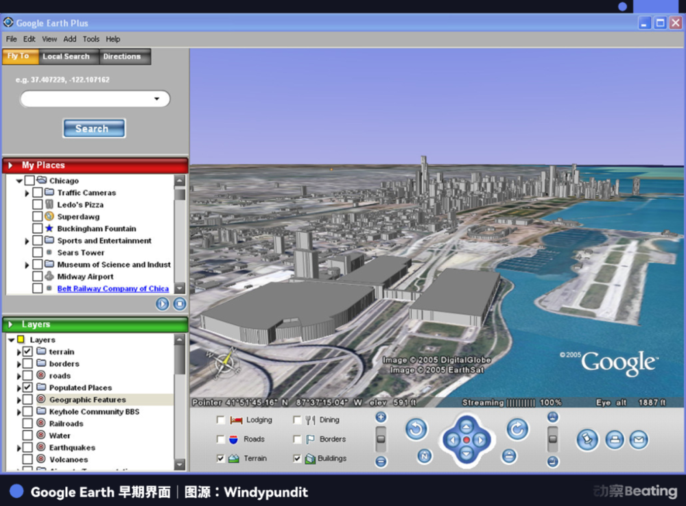
CIA's In-Q-Tel invested in Keyhole in 2003 for ground-level intel from satellite imagery.
Why It Matters
Exposes how consumer apps harvest data for dual-use AI/military tech, raising privacy concerns for devs building location-based AI.
What To Do Next
Integrate Niantic's Lightship ARDK to test geospatial data pipelines for vision models.
Key Points
- •CIA's In-Q-Tel invested in Keyhole in 2003 for ground-level intel from satellite imagery.
- •Pokémon Go mechanics drove users to scan locations, creating multi-angle 3D building models.
- •Google Street View scandal exposed Wi-Fi data snooping, normalized 'apologize later' data grabs.
- •Niantic now channels game data to military AI global mapping.
🧠 Deep Insight
Background and context from public sources — not the original article. 4 sources cited.
🔑 Enhanced Key Takeaways
- •Niantic's Visual Positioning System (VPS) leverages Pokémon Go player-submitted images to create precise AR anchors, enabling centimeter-level accuracy for mapping worldwide landmarks.
- •In 2021, Niantic secured a US Army contract via the xTechSearch program to develop AR tools for soldier training using its geospatial platform.
- •John Hanke confirmed in 2015 interviews that Niantic's mission extends mapping technology to support global AR infrastructure beyond gaming.
- •Keyhole's EarthViewer software, funded by In-Q-Tel, allowed seamless 'flight' from space to street level with overlaid intelligence data layers.[3]
🛠️ Technical Deep Dive
- •Keyhole's EarthViewer 3D system integrated satellite imagery with terrain data for interactive 3D visualization, enabling users to combine roads, demographics, and other layers into realistic models.[3]
- •Niantic's scanning in Pokémon Go captures multi-perspective photos via the VPS, processed into 3D point clouds for AR localization without GPS reliance.
🔮 Future ImplicationsAI analysis grounded in cited sources
⏳ Timeline
📎 Sources (4)
Factual claims are grounded in the sources below. Forward-looking analysis is AI-generated interpretation.
Weekly AI Recap
Read this week's curated digest of top AI events →
👉Related Updates

AI-curated news aggregator. All content rights belong to original publishers.
Original source: 虎嗅 ↗
This is a summary, not the original. Read the source, or get the weekly briefing.
Weekly AI briefing
One email a week. Unsubscribe anytime.