Scaling Geospatial Search with Multimodal AI
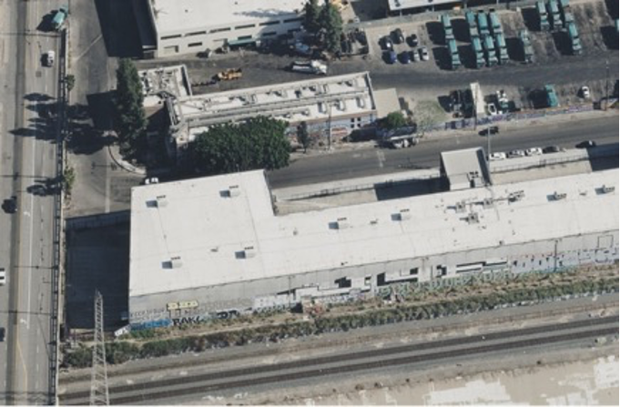
Learn how to build high-performance multimodal search for aerial imagery using Amazon Bedrock and OpenSearch.
30-Second TL;DR
What Changed
Utilized Amazon Nova Multimodal Embeddings for superior F1 scores in geospatial queries.
Why It Matters
This research provides a blueprint for developers building large-scale multimodal search engines for specialized domains like geospatial imagery. It highlights the effectiveness of Amazon Nova models in handling complex, non-textual data at scale.
What To Do Next
Evaluate Amazon Nova Multimodal Embeddings for your next project requiring high-accuracy semantic search on visual datasets.
Key Points
- •Utilized Amazon Nova Multimodal Embeddings for superior F1 scores in geospatial queries.
- •Built an evaluation framework using OpenStreetMap ground truth data.
- •Compared various fusion strategies, captioning techniques, and search methods for aerial imagery.
- •Successfully transitioned experimental findings into the production-grade Vexcel Intelligence product.
Deep Insight
AI-generated analysis for this event — not the original article.
Enhanced Key Takeaways
- •The integration leverages Amazon Nova's native multimodal capabilities to process high-resolution aerial imagery without requiring separate object detection pipelines, significantly reducing latency.
- •Vexcel Intelligence utilizes a proprietary 'Geo-Spatial Indexing' layer within OpenSearch Serverless that maps vector embeddings to specific WGS84 coordinates for sub-meter search accuracy.
- •The system employs a hybrid search approach, combining vector similarity with traditional metadata filtering (e.g., date of capture, cloud cover percentage) to improve retrieval precision.
- •AWS and Vexcel implemented a custom 'Contrastive Learning' fine-tuning process on the Nova model to better recognize specific land-use features like solar panels, swimming pools, and roof damage.
- •The platform architecture supports real-time ingestion of new aerial captures, allowing the search index to update within minutes of image processing completion.
Competitor Analysis
- Vexcel Intelligence (AWS)
- Multimodal Semantic Search
- Google Earth Engine
- Scientific Geospatial Analysis
- Mapbox Search API
- Map Rendering & Geocoding
- Vexcel Intelligence (AWS)
- Amazon Nova (Multimodal)
- Google Earth Engine
- Custom/External
- Mapbox Search API
- Proprietary/External
- Vexcel Intelligence (AWS)
- Natural Language/Semantic
- Google Earth Engine
- Query-based/Scripted
- Mapbox Search API
- Keyword/Geospatial
- Vexcel Intelligence (AWS)
- Consumption-based (Serverless)
- Google Earth Engine
- Tiered/Research Grants
- Mapbox Search API
- Pay-per-request
| Feature | Vexcel Intelligence (AWS) | Google Earth Engine | Mapbox Search API |
|---|---|---|---|
| Core Focus | Multimodal Semantic Search | Scientific Geospatial Analysis | Map Rendering & Geocoding |
| Embedding Model | Amazon Nova (Multimodal) | Custom/External | Proprietary/External |
| Search Type | Natural Language/Semantic | Query-based/Scripted | Keyword/Geospatial |
| Pricing | Consumption-based (Serverless) | Tiered/Research Grants | Pay-per-request |
Technical Deep Dive
- Architecture utilizes Amazon Bedrock for hosting the Nova Multimodal model, which generates 1024-dimensional vectors for image tiles.
- Image tiles are pre-processed using a sliding window approach to maintain spatial context during embedding generation.
- OpenSearch Serverless k-NN (k-Nearest Neighbors) plugin is configured with the HNSW (Hierarchical Navigable Small World) algorithm for efficient vector search.
- The fusion strategy involves late-stage concatenation of image embeddings with metadata-derived text embeddings to create a unified search space.
- Data pipeline utilizes AWS Step Functions to orchestrate the flow from raw imagery ingestion to vector database indexing.
Future ImplicationsAI analysis grounded in cited sources
Timeline
- 2023-05Vexcel Imaging announces expansion of its aerial imagery library to cover major global urban centers.
- 2024-09AWS introduces Amazon Nova foundation models, enabling advanced multimodal processing capabilities.
- 2025-03Vexcel Intelligence begins pilot testing of AI-driven semantic search features on AWS infrastructure.
- 2026-02Official production launch of the Vexcel Intelligence platform integrated with Amazon Bedrock and OpenSearch Serverless.
Weekly AI Recap
Read this week's curated digest of top AI events →
Related Updates

AI-curated news aggregator. All content rights belong to original publishers.
Original source: AWS Machine Learning Blog ↗
This is a summary, not the original. Read the source, or get the weekly briefing.
The weekly digest
One email a week. Unsubscribe anytime.