🇨🇳cnBeta (Full RSS)•Stalecollected in 52m
Niantic Repurposes Pokemon Go AR for Robot Maps
💡Pokemon Go AR data enables cm-precise robot delivery maps in cities
⚡ 30-Second TL;DR
What Changed
Repurposes Pokemon Go AR data for delivery robot navigation
Why It Matters
Expands gaming AR tech into logistics robotics, creating new revenue streams and advancing embodied AI navigation in real-world apps.
What To Do Next
Integrate Niantic VPS API into your robot project for urban navigation testing.
Who should care:Developers & AI Engineers
🧠 Deep Insight
Web-grounded analysis with 5 cited sources.
🔑 Enhanced Key Takeaways
- •Niantic Spatial, a spin-off company announced in March 2025, developed the Visual Positioning System (VPS) using data from Pokémon Go and Ingress.[1][2][4]
- •The VPS model was trained on 30 billion images captured by players, with dense coverage around over one million game hotspots worldwide for high-accuracy positioning.[1][2]
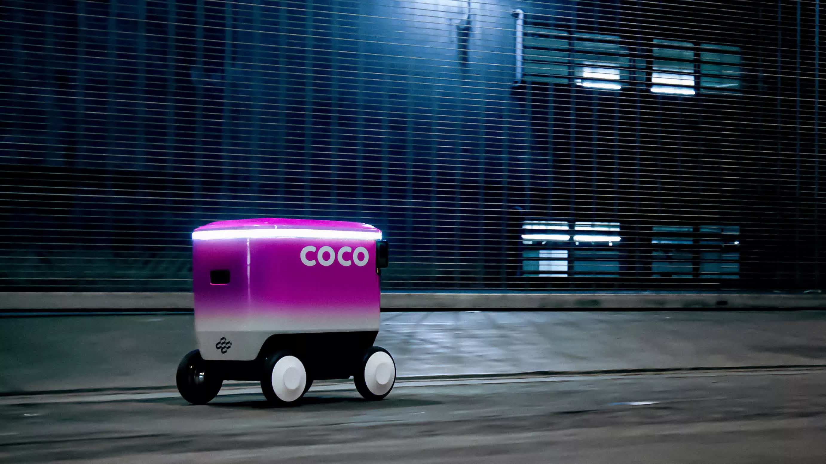
- •Coco Robotics' delivery robots use four hip-height cameras to feed images into the VPS, enabling precise navigation despite perspective differences from player data.[2]
- •The system supports direction-aware positioning and extends accuracy beyond hotspots through model predictions on sparse data.[2]
🛠️ Technical Deep Dive
- •VPS uses visual landmark recognition from smartphone images to achieve centimeter-level positioning, trained via photogrammetry on player-submitted AR scans from Pokémon Go's AR Mapping feature introduced in fall 2020.[4]
- •Model processes snapshots of buildings to predict location and facing direction, with over 30 billion urban images, densest at one million+ game hotspots.[1][2]
- •Integrates with robot hardware like Coco's four omnidirectional cameras at hip height; data adaptation handles viewpoint shifts from player eye-level.[2]
🔮 Future ImplicationsAI analysis grounded in cited sources
Delivery robots using VPS will reduce navigation errors by over 50% in GPS-denied urban zones
Crowdsourced image data and robot feedback loops enable continuous model improvement, mirroring gains in self-driving tech like Waymo.[3]
Niantic's Living Map will cover 10 million+ locations by 2027
⏳ Timeline
2013-12
Niantic releases Ingress, starting AR data collection for visual mapping.
2016-07
Pokémon Go launches, generating billions of player-captured images in urban areas.
2020-10
Introduces AR Mapping feature in Pokémon Go, crowdsourcing photogrammetry scans as Field Research.
2025-03
Announces Niantic Spatial spin-off to commercialize VPS from game data.
2026-03
Partners with Coco Robotics for VPS integration in delivery robot navigation.
📎 Sources (5)
Factual claims are grounded in the sources below. Forward-looking analysis is AI-generated interpretation.
- phemex.com — Niantic Leverages Pokmon Go Data for Advanced Robot Navigation 65955
- kucoin.com — Niantic Uses 3 Billion Pok Mon Go Photos to Train Robot Navigation System
- popsci.com — Pokemon Go Delivery Robots Crowdsourcing
- hackaday.com — Pokemon Go Had Players Capturing More Than They Realized
- techspot.com — 111690 Pokmon Go Ar Data Has Turned Centimeter Accurate
📰
Weekly AI Recap
Read this week's curated digest of top AI events →
👉Related Updates


AI-curated news aggregator. All content rights belong to original publishers.
Original source: cnBeta (Full RSS) ↗