Grab, WeRide Launch Singapore Robotaxis
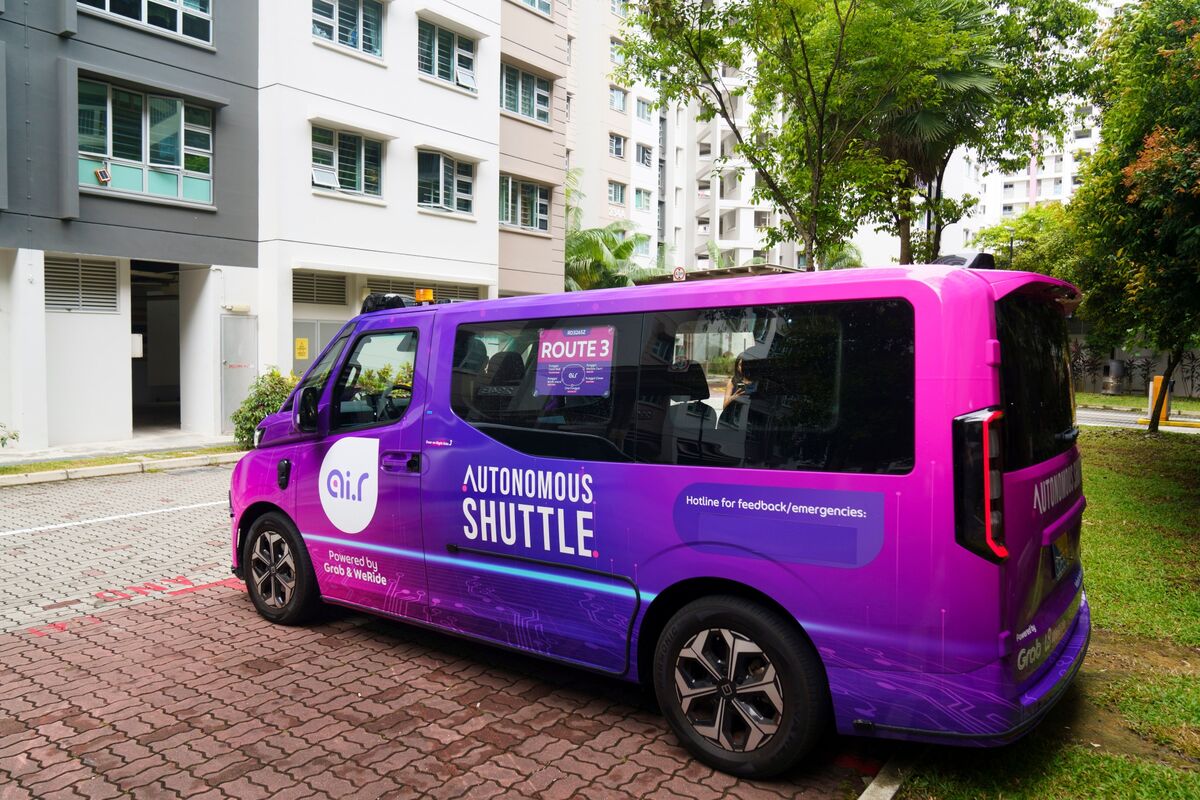
💡SE Asia's first robotaxi tests AV scalability in dense cities
⚡ 30-Second TL;DR
What Changed
Grab becomes Southeast Asia's first ride provider with driverless service
Why It Matters
This launch signals growing AV adoption in Asia, potentially accelerating robotaxi commercialization beyond China. It provides real-world data for AI training in complex traffic, influencing global AV strategies.
What To Do Next
Explore WeRide's AV simulation tools for urban robotaxi deployment testing.
Key Points
- •Grab becomes Southeast Asia's first ride provider with driverless service
- •Partnership with WeRide for robotaxi deployment in Singapore
- •Focus on cost-cutting and testing in dense urban traffic
🧠 Deep Insight
AI-generated analysis for this event — not the original article.
🔑 Enhanced Key Takeaways
- •The deployment utilizes WeRide's Gen6 robotaxi platform, which features a modular sensor suite integrated directly into the vehicle roof for enhanced 360-degree perception in Singapore's tropical weather conditions.
- •The service is currently restricted to a geofenced area within the one-north business district, operating under a specific regulatory sandbox permit granted by the Land Transport Authority (LTA).
- •Grab's integration strategy involves a 'hybrid' model where users can toggle between standard human-driven vehicles and autonomous options within the existing Grab app interface, leveraging their existing user base to drive adoption.
📊 Competitor Analysis▸ Show
| Feature | Grab/WeRide (Singapore) | ComfortDelGro/AutoDrive | Waymo (US) |
|---|---|---|---|
| Operational Model | Hybrid (Human/AV) | Pilot/Research | Pure-play AV |
| Sensor Suite | LiDAR/Camera/Radar | LiDAR/Camera | LiDAR/Camera/Radar |
| Market Focus | SE Asia Urban | Singapore Campus | US Urban/Suburban |
| Pricing | Dynamic (App-based) | N/A (Research) | Distance/Time-based |
🛠️ Technical Deep Dive
- •Platform: WeRide Gen6 Robotaxi, built on a mass-production-ready chassis.
- •Sensor Fusion: Employs a multi-modal sensor fusion architecture combining high-resolution LiDAR, 4D imaging radar, and high-definition cameras to handle heavy rain and low-light conditions.
- •Compute: Utilizes a centralized high-performance computing unit capable of processing multi-terabyte data streams per hour for real-time path planning.
- •Redundancy: Implements multi-level hardware redundancy for steering, braking, and power systems to ensure safety in the event of a primary system failure.
🔮 Future ImplicationsAI analysis grounded in cited sources
⏳ Timeline
Weekly AI Recap
Read this week's curated digest of top AI events →
👉Related Updates


AI-curated news aggregator. All content rights belong to original publishers.
Original source: Bloomberg Technology ↗
This is a summary, not the original. Read the source, or get the weekly briefing.
Weekly AI briefing
One email a week. Unsubscribe anytime.