Google Maps Adds Gemini AI for Ask Maps & 3D Nav
💡Gemini transforms Maps with conversational AI & 3D nav—key for location AI devs.
⚡ 30-Second TL;DR
What Changed
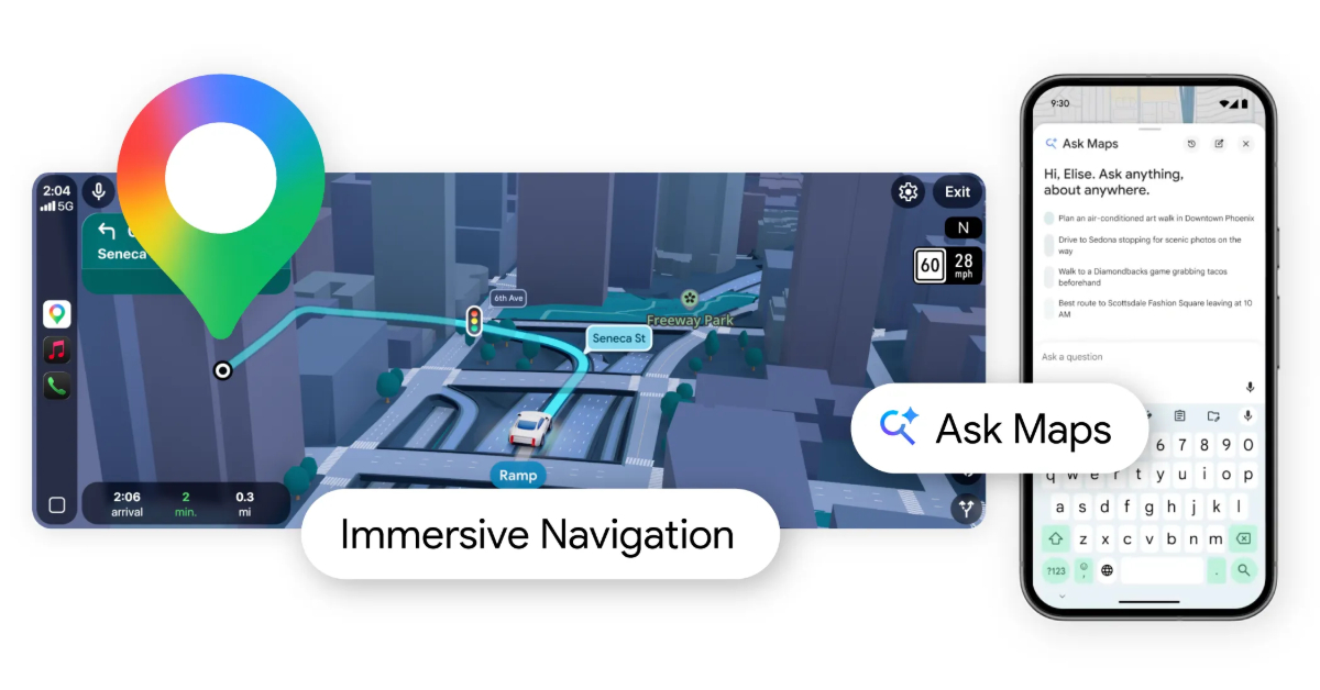
'Ask Maps' enables conversational queries for complex location conditions.
Why It Matters
Gemini's integration into Google Maps demonstrates scalable LLM applications in consumer navigation, potentially boosting user retention and influencing competitors. It sets a precedent for multimodal AI in everyday tools.
What To Do Next
Check Google Maps Platform docs for Gemini API access to build AI-enhanced location apps.
🧠 Deep Insight
Web-grounded analysis with 8 cited sources.
🔑 Enhanced Key Takeaways
- •Ask Maps rollout began in the U.S. and India on Android and iOS mobile apps, with plans for expansion to personal computers and additional countries[2][3][5].
- •Immersive Navigation uses Gemini to analyze Street View and aerial photos for 3D renderings including transparent buildings, overpasses, medians, crosswalks, and traffic lights[1][4][5].
- •Landmark-based navigation references visible real-world spots like restaurants and gas stations, cross-referenced with data on 250 million places, now available in the U.S. on Android and iOS[1][2].
- •New features include proactive traffic alerts for road closures, smart zooms for upcoming turns, alternate route tradeoffs like tolls vs. traffic, and destination Street View previews[1][4][5].
- •Lens with Gemini identifies places and answers questions about them, starting gradual rollout in the U.S. on Android and iOS[1].
🛠️ Technical Deep Dive
- •Gemini models analyze Street View images and aerial photos, cross-referenced with data on 250-300 million places and 500 million contributor reviews, to generate accurate 3D views and landmarks[1][3][4][5].
- •Ask Maps draws from comprehensive place database for personalized itineraries and complex queries, pre-trained with real-world info for spatial understanding[3][4][5].
- •Immersive Navigation includes smart zooms, transparent building overlays, and natural voice guidance like 'Go past this exit and take the next one'[4][5].
- •Gemini API now includes Maps Grounding for developers to build agents accessing live Google Maps data on 250 million places[6].
🔮 Future ImplicationsAI analysis grounded in cited sources
⏳ Timeline
📎 Sources (8)
Factual claims are grounded in the sources below. Forward-looking analysis is AI-generated interpretation.
- Google Blog — Gemini Navigation Features Landmark Lens
- TechCrunch — Google Maps Is Getting an AI Ask Maps Feature and Upgraded Immersive Navigation
- abcnews.com — Google Overhauls Maps App Adding AI Features People 130996333
- techradar.com — Our Biggest Navigation Upgrade in Over a Decade Google Maps Gets Two Massive Gemini Powered Features That Youre Going to Use All the Time
- Google Blog — Ask Maps Immersive Navigation
- youtube.com — Watch
- the-independent.com — Immersive Navigation Google Maps Gemini AI B2937796
- techgenyz.com — Google Maps AI Update Ask Maps Immersive Navigation
Weekly AI Recap
Read this week's curated digest of top AI events →
👉Related Updates
AI-curated news aggregator. All content rights belong to original publishers.
Original source: ITmedia AI+ (日本) ↗